Geophysical training and courses provide professionals with knowledge they need to setup and operate instruments, which assists with understanding and conducting geophysical surveys. Companies often have access to various sources of information, such as conferences, seminars, and online courses. Many universities also offer degree programs in geophysics that can provide students with a thorough understanding of the field. Geophysical training and courses can help professionals better grasp fundamentals of how to use software tools, as well as how to manage data acquisition processes. Currently, there are links to topics about electromagnetic, GPR, and ground vibration surveys. Hopefully, more to come in the near future. With appropriate research and dedication, individuals can gain valuable insights into geological processes while developing skills that will be useful in their future careers.
Understanding Geonics Instruments
Having a comprehensive understanding of Geonics Instruments is essential when renting or using their equipment for geophysical investigations. It is important to ensure that all personnel operating the instruments are properly trained in their use, as well as the interpretation of data collected. In addition to a basic instruction and an overview of how the equipment functions, more advanced training may also be available. This can include topics such as field protocols, instrument configuration, software programming, data analysis, and application specific tips. Additionally, many providers offer routine maintenance checks or technical support services to help keep your equipment running optimally.
With proper training and understanding of Geonics Instruments, users can confidently use these powerful tools to maximize results from their geophysical surveying projects. If you’re searching for something more than just the basics on electromagnetic terrain conductivity and metal detection, GeonicsTraining.com is your ideal source! Their unparalleled pages will assist you with your journey.
Working With Sensors & Software’s Noggin, pulseEKKO Pro Ultra, and Conquest systems
Sensors & Software’s Noggin, pulseEKKO Pro Ultra, and Conquest systems can be a challenge; each system has its own range of features and abilities to consider. For example, the Noggin provides a reliable, high-resolution imaging capability for surveying even the most complex targets. Its antenna design ensures superior performance in various data acquisition scenarios and its cutting-edge software delivers unmatched accuracy in imaging results. The pulseEKKO Pro Ultra offers an even more extensive selection of features including advanced stacking capabilities for greater depths and sharper underground images. It also offers exceptional flexibility to customize settings for specific projects as well as a host of built-in tools designed to tasks. Finally, the Conquest is an ideal solution for surveying concrete structures or other applications that require a more lightweight system. It boasts a powerful digital signal processing technology which allows it to outperform many larger GPR systems while still maintaining unbeatable accuracy at an affordable price point.
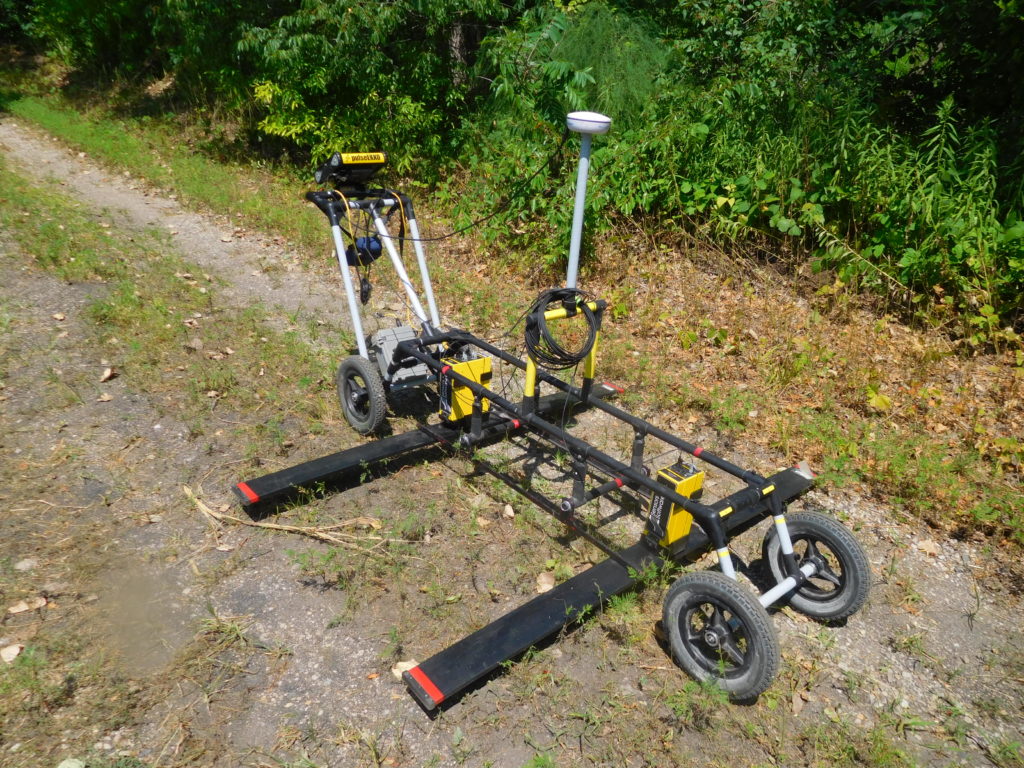
When operating GPR systems, these three Sensors & Software models represent some of the best options available today due to their superior performance and cost efficiency. Are you looking for more than just the fundamentals of GPR? Look no further – GPRTrainingCourses.com has what you need! Our pages are like no other, offering a wide selection of how to text that will get you up and running.
Ground Vibration Monitoring with Instantel’s Micromate, Minimate, Blastmate seismographs.
Instantel’s Micromate, Minimate and Blastmate seismographs are state-of-the-art ground vibration monitoring systems designed to provide reliable and accurate measurements of ground vibrations. These instruments can be used for both short-term observations in real-time and long-term studies over extended periods. Their systems feature advanced technology that can detect small changes in the environment that might be otherwise difficult to detect. Each system is capable of capturing three-dimensional measurements using accelerometers, pressure transducers, and/or microphones. This data can then be used to calculate peak particle velocity, frequency, and more. Additionally, Instantel’s software solutions allow users to analyze the data collected by these systems quickly and efficiently. They offer customizable report templates that make it easy to visualize the impact of vibration on structures over time.
The scalability of their systems also allows them to be used in a variety of environments including residential homes, industrial facilities, construction sites, mines, quarries, and more. By learning how to operate one or multiple systems from Instantel, professionals can easily monitor the environment for potential threats while protecting assets from damaging vibrations. VibrationMonitoringCourses.com is an excellent resource for those looking to learn about Instantel’s Micromate, Minimate, and Blastmate seismographs. The website provides comprehensive information about these products and how they can be used in vibration monitoring applications. Visitors can find product overviews, detailed descriptions of features, comparison charts, troubleshooting, and other helpful resources. Additionally, users can access expert guidance from experience. By leveraging their knowledge and expertise, visitors to VibrationMonitoringCourses.com can become more knowledgeable about Instantel’s products and confidently use them in their vibration monitoring projects for improved accuracy and reliability.
In conclusion, there are a variety of geophysical surveying and ground vibration monitoring solutions available on the market today.
Whether you need to survey a large area or monitor vibrations in an environment, these systems can help you get reliable results quickly and efficiently. With proper training and understanding of how to use them properly, users can confidently leverage the power of GPRs and seismographs for their projects. Additionally, many providers offer technical support services so that any issues with your equipment can be resolved quickly. Ultimately, by investing in high-quality instruments from respected manufacturers such as Geonics Instruments, Sensors & Software, or Instantel businesses will have access to geophysical tools that enable accurate data collection with minimal effort.